Solution Found!
Get solution: Use the data in the BlackHills folder and Sturgis83 geodatabase to answer
Chapter 10, Problem 6(choose chapter or problem)
Use the data in the BlackHills folder and Sturgis83 geodatabase to answer the following questions.Because solution methods can vary, your answers may be slightly different from the ones in theback of the book. Areas that are within 300 meters of both streams and primitive roads are the most popularplaces for fishing. Create a map showing these areas. Capture your map.
Questions & Answers
QUESTION:
Use the data in the BlackHills folder and Sturgis83 geodatabase to answer the following questions.Because solution methods can vary, your answers may be slightly different from the ones in theback of the book. Areas that are within 300 meters of both streams and primitive roads are the most popularplaces for fishing. Create a map showing these areas. Capture your map.
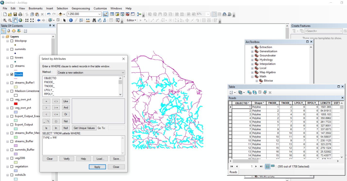
ANSWER:Step 1 of 2
First export primitive roads from the roads layer by using select by the attribute tool as shown in below image