Solution Found!
Now solved: Use the data in the BlackHills folder and Sturgis83 geodatabase to answer
Chapter 10, Problem 7(choose chapter or problem)
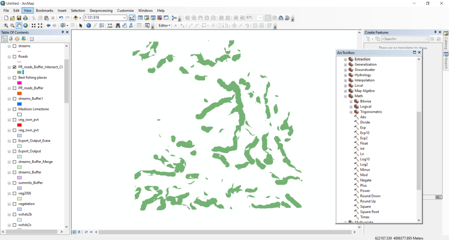
Use the data in the BlackHills folder and Sturgis83 geodatabase to answer the following questions.Because solution methods can vary, your answers may be slightly different from the ones in theback of the book. The fishing areas in #6 should be restricted to areas within the national forest (OWNER =NFS in the vegetation feature class). Create a revised map showing the public access fishingareas in green and the private fishing areas in red. Capture your map
Questions & Answers
QUESTION:
Use the data in the BlackHills folder and Sturgis83 geodatabase to answer the following questions.Because solution methods can vary, your answers may be slightly different from the ones in theback of the book. The fishing areas in #6 should be restricted to areas within the national forest (OWNER =NFS in the vegetation feature class). Create a revised map showing the public access fishingareas in green and the private fishing areas in red. Capture your map
ANSWER:Step 1 of 2
Here we are using the final output of question no. 6 final output for solving this problem. First we have to clip the vegetation layer according to popular fishing areas layer below shows the output image