Solution Found!
See answer: Use the data in the BlackHills folder and Sturgis83 geodatabase to answer
Chapter 10, Problem 10(choose chapter or problem)
Use the data in the BlackHills folder and Sturgis83 geodatabase to answer the following questions. Because solution methods can vary, your answers may be slightly different from the ones in the back of the book.
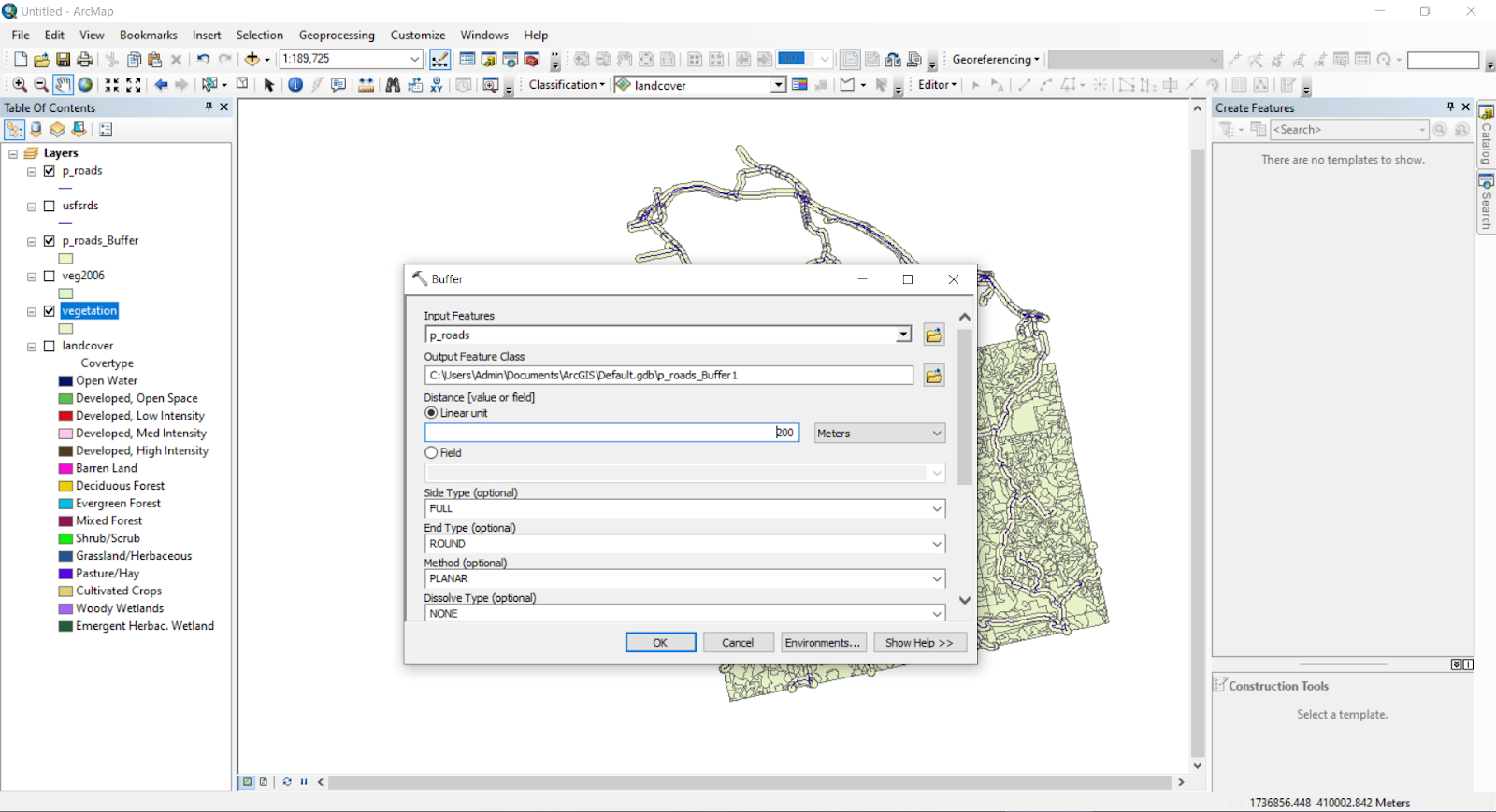
The Forest Service is considering adopting a policy to not cut timber within 200 meters of a primary road (TYPE = P). Assuming that cutting timber includes all SSTAGE96 LIKE ‘4*’, determine the total area in square kilometers lost to harvesting if this policy were adopted. Capture a map showing the off-limits areas.
Questions & Answers
QUESTION:
Use the data in the BlackHills folder and Sturgis83 geodatabase to answer the following questions. Because solution methods can vary, your answers may be slightly different from the ones in the back of the book.
The Forest Service is considering adopting a policy to not cut timber within 200 meters of a primary road (TYPE = P). Assuming that cutting timber includes all SSTAGE96 LIKE ‘4*’, determine the total area in square kilometers lost to harvesting if this policy were adopted. Capture a map showing the off-limits areas.
ANSWER:Step 1 of 2
Open the ArcMap and click add data then navigate to Sturgis83 geodatabase and add the vegetation and roads layers as shown in the below image

Now we have to select primary roads and export into another layer by placing a query TYPE = 'P' as shown below

After that, we need to find 200 meters buffer for primary roads